![['the civilized explorer'.]](../src/civex.gif)
[Site TOC]
You are here:
The Civilized Explorer >
Guadeloupe >
Photos of La Soufriere
This page contains links to JPG images of the photos included in the Civilized
Explorer family of pages. Unless otherwise stated, all JPGs are scanned
at 32 bits and 72 dpi. File size is shown as compressed on the disk. File
dimensions are in pixels. Copyright information and how to get permission to
use the images is
here.
 "Climbing up La Soufriere"
is 502 x 742, about 197k. It shows a person on the rocky climb up the side of
La Soufriere in April of 2000.
"Climbing up La Soufriere"
is 502 x 742, about 197k. It shows a person on the rocky climb up the side of
La Soufriere in April of 2000.
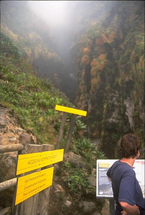
 "The End of the Trail"
is 501 x 741, about 53k. It shows the end of the trail, with signs prohibiting
further ascent because of toxic gasses.
"The End of the Trail"
is 501 x 741, about 53k. It shows the end of the trail, with signs prohibiting
further ascent because of toxic gasses.
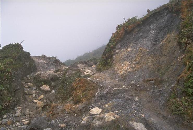
 "A treacherous part of the trail"
is 741 x 497, about 60k. The trail has suffered considerable erosion since our
last climb. Since the crater area is closed, the trail is not being maintained
past the signs.
"A treacherous part of the trail"
is 741 x 497, about 60k. The trail has suffered considerable erosion since our
last climb. Since the crater area is closed, the trail is not being maintained
past the signs.
360-Degree Panoramas of the crater and other views from Guadeloupe and Les Saintes.
Copyright © 2000, The Civilized Explorer. ALL RIGHTS RESERVED. You may make one copy of any photograph for your personal viewing, but you may not use the copy for public display or to be included in any Web page or printed material. You may not link to these photos for inclusion in any Web page. See our copyright page for additional information, including how to get permission to use our photographs.